What and Where Is East Jerusalem?
Recent news report: “Prime Minister Benjamin Netanyahu is expected to approve plans to build 1,400 new homes in both the West Bank and East Jerusalem in the coming days.”
When we bring visitors to the Sherover-Haas Promenade in our Talpiot neighborhood, with its magnificent vista of the old and new Jerusalem skyline, they often ask, “So, where is East Jerusalem?”
And we find ourselves pointing in all directions because the term is artificial and a misnomer.
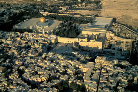
Jerusalem is a city built on hills, embedded on a mountain ridge. Samaria lies to the north, Judea to the south. The city has no grid system—no Fifth Avenue, as in New York City, to divide the east and west sides.
Until Israel’s victory in the June 1967 Six-Day War, parts of Jerusalem were artificially separated along the armistice lines that ended the 1948 War of Independence. Parts of North, South, and East Jerusalem lay under control of the Hashemite Kingdom of Jordan.
By June 28, 1967, the barriers that had divided Jerusalem were dismantled. The city—whose boundaries have since been expanded beyond the municipal borders demarcated by Jordan—was incorporated into Israel proper. The annexation was opposed by the U.S. State Department and condemned by the UN Security Council.
No country recognizes Jerusalem—not even “western” Jerusalem—as Israel’s capital. And Israel held “western” Jerusalem when the city was divided.
The Palestinian Arab population of “east” Jerusalem was granted the right to vote in municipal elections but has opted to boycott political participation. Still, Jerusalem Arabs carry ordinary blue Israeli ID cards like mine that allow them to make full use of universal health coverage and the social welfare benefits available to all Israeli citizens.
At the time of reunification, former Premier David Ben-Gurion called for a national effort to settle the empty, formerly Jordanian spaces of metropolitan Jerusalem.
International opposition notwithstanding, all Israeli governments have worked on a bipartisan basis to solidify Jewish control of the city by constructing a string of strategically placed residential neighborhoods: Gilo and Har Homa in the south; East Talpiot in the east; Ramat Eshkol, French Hill, Pisgat Ze’ev, and Neve Yaakov in the north; and Ramot and Ramat Shlomo on the northern flank of the Jerusalem-Tel Aviv Highway.
All these neighborhoods, as well as Jerusalem’s walled Old City, fall under the East Jerusalem blanket. And the international community considers them “settlements” in the “occupied territories.”
Jordanian government land and some private land were confiscated, but most of the sites chosen for these “settlements” were unpopulated.
Only in recent years have small numbers of ideological settlers moved into densely populated Arab neighborhoods, such as the City of David, the Muslim Quarter of the Old City, and Sheikh Jarrah (also known as Shimon HaTzadik).
A further word about Ramat Shlomo, since it comes up again and again in the news. Any routine, bureaucratic approval of additional dwellings within this existing and fervently Orthodox neighborhood is invariably leaked to the media by Peace Now lobbyists (the group is primarily funded by the European Union and foreign foundations). When this happens, for example, during a visit by U.S. Vice President Joe Biden or Secretary of State John Kerry, it ignites a faux crisis in U.S.-Israel relations.
On June 19, 1967, U.S. President Lyndon Johnson declared, “No one wishes to see the Holy City again divided.”
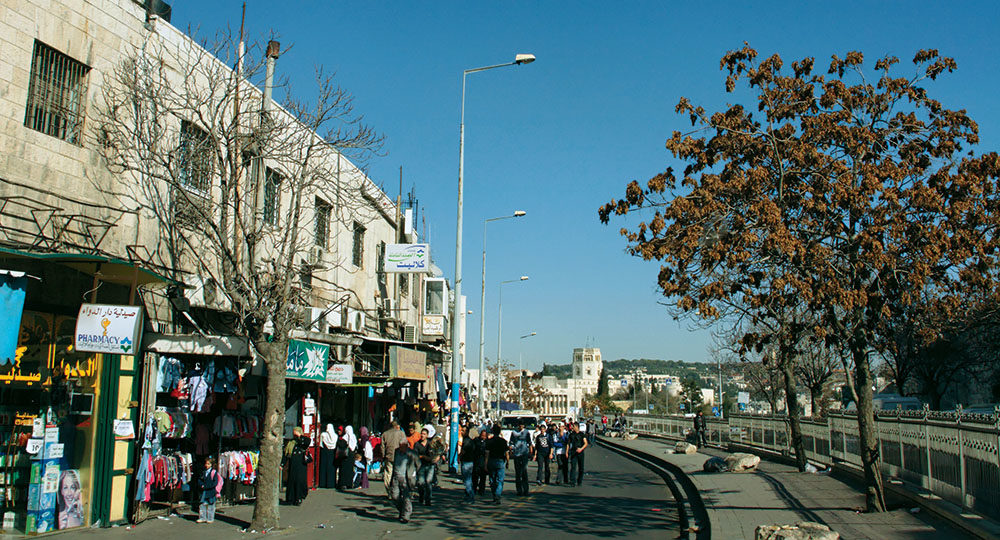
Today even casual visitors can readily appreciate that the city is a mosaic of neighborhoods built on hills and in valleys where Jews and Arabs live in proximity and share common public spaces. They attend the same Hebrew University, have access to the same hospitals, and shop in some of the same supermarkets.
With mutual generosity and goodwill, the city can be peaceably shared. But to imagine Jerusalem divisible along an east-west axis bespeaks a profound ignorance of political geography.
