The ‘Heart’ of the Promised Land: The Shephelah, Jezreel Valley, and Jordan Valley
Three strategic geological formations protect the “heart” of the land of Israel. Whoever controls these formations controls the Jewish nation’s vital interior. These formations consist of the Shephelah, the Jezreel Valley, and the Jordan Valley.
The Shephelah
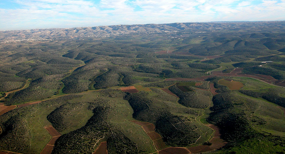
The Shephelah (Hebrew for “lowlands” and pronounced she-FĀ-lä) designates an undulating cluster of grassy, limestone foothills located between Israel’s coastal plain and the Judean hill country. The Shephelah is roughly 10 miles wide and 27 miles long, ranging in height from 500 to 1,500 feet.
In biblical days, it was known for its olive and sycamore trees (1 Ki. 10:27; 1 Chr. 27:28). Its valleys were also used for growing wheat (1 Sam. 6:13).
Five east-west valleys intersect the Shephelah: the Aijalon, Sorek, Elah, Guvrin, and Lachish.
The Aijalon Valley provides access to the area north of Jerusalem. Significant biblical cities of the Aijalon Valley were Aijalon itself, situated in the eastern part of the valley, and Gezer, guarding the valley’s western entrance. Because of the thoroughfare from the port city of Joppa up to Jerusalem, Gezer became the most strategic city in the Shephelah.
The Sorek Valley also provides direct access to Jerusalem, but in biblical days it was much more difficult to travel. Its important cities included Beth Shemesh towards the center and the twin cities of Zorah and Eshtaol, at the valley’s north-east corner.
The Elah Valley provides access to the area near Bethlehem. Significant cities here were Gath at the western entrance; Azekah, towards the center; and Adullam, in the east.
The Guvrin, or Zephathah, Valley does not provide access to the hill country.
The Lachish Valley provides access to Hebron. Its only important biblical city was Lachish itself, located in the center of the valley and functioning as a southern sentinel between Judah and Egypt.
Joshua allotted the northern section of the Shephelah to the tribe of Dan (Josh. 19:40–46). The rest belonged to the tribe of Judah (15:20, 33).
In the Shephelah, Joshua prayed for the sun and moon to stop in their courses (Josh. 10:12–13, 40). Samson loved a woman named Delilah in the Valley of Sorek (Jud. 16:4). David slew Goliath in the Valley of Elah (1 Sam. 17). Of the 15 fortified cities King Solomon’s son Rehoboam built for defending Jerusalem, eight were in the Shephelah (2 Chr. 11:5–10).
Good King Asa defeated a million-man army in the Zephathah Valley (2 Chr. 14:10). In the days of wicked King Ahaz, the Philistines captured certain cities of the Shephelah (2 Chr. 28:18). And the cities of Lachish and Azekah, along with Jerusalem, were the last holdouts against the Babylonians (Jer. 34:7).
In recent times, the main road from Tel Aviv to Jerusalem was built to wind its way through the entrance of the Aijalon Valley, then on to follow the foothills just north of Eshtaol. During Israel’s War of Independence in 1948, this road was constantly under Arab attack. One of Israel’s bloodiest defeats took place at Latrun, which was a police station south of the biblical city of Aijalon.
Today the Shephelah is under full Israeli sovereignty and is mostly farmland. Located there is the modern city of Beit Shemesh, situated near the Old Testament Beth Shemesh, where the Ark of the Covenant returned on a cart from Philistine territory, drawn by two cows (1 Sam. 6:13).
In the future Millennial Kingdom, men will buy land in the Shephelah, shepherds will count their flocks there, and the Shephelah’s inhabitants will possess the coastal plain of the Philistines (Jer. 32:44; 33:13; Obad. 19).
The Jezreel Valley
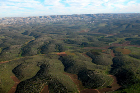
The Jezreel Valley is actually a collective term for the Valley of Megiddo and the Jezreel Valley. Together, they form a triangle of more than 141 square miles in northern Israel in the Galilee. The Valley of Megiddo (2 Chr. 35:22) lies between the Mount Carmel ridge on the south and the Nazareth ridge on the north. The Valley of Megiddo is named after the ancient city of Megiddo, a strategically vital place in the middle of the Carmel ridge, protecting the entrance to the most traveled pass in the region.
Going southeast, the Valley of Megiddo merges into the Jezreel Valley (Josh. 17:16), named after the city of Jezreel. Site of one of Ahab’s palaces (1 Ki. 21:1), the city of Jezreel lay strategically in the center of the valley, 200 feet above the plain, on the lower northwestern edge of the Mount Gilboa ridge.
Across the valley to the north is the Hill of Moreh, on which such well-known biblical towns as Endor on the northeast, Shunem on the south, and Nain on the north were located (Josh. 17:11; 19:18; Lk. 7:11). Slightly to the north of Moreh is Mount Tabor (elevation 1,900 feet), an almost perfectly round geological formation. To the west of Mount Tabor on the Nazareth ridge is the city of Nazareth, Jesus’ boyhood hometown. Standing on the ridge near Nazareth, perhaps the precipice from which the residents of Nazareth tried to throw Jesus, one can almost view the entire valley (Lk. 4:28–30). At the extreme southeastern end of the Jezreel Valley, at an important crossroad, lay the city of Beth-Shean, guardian to the valley’s eastern portal (Jud. 1:27). The Romans developed Beth-Shean extensively and called it Scythopolis.
The Israelite tribes of Manasseh, Zebulun, and Issachar shared the allotment of the Jezreel Valley. But the Canaanites here were difficult to conquer. They had iron chariots, a distinct advantage in such wide-open plains (Josh. 17:16).
The Jezreel Valley has been the location of numerous military conflicts throughout history due to its ideal battlefield contours. Deborah and Barak swept down from Mount Tabor and trounced Sisera near Megiddo (Jud. 4:1–23; 5:19, 21). Gideon defeated the Midianites just south of the Hill of Moreh (Jud. 6—7). The Philistines defeated King Saul near Mount Gilboa (1 Sam. 29:1; 31:1–13). They fastened Saul’s body to the city wall of Beth-Shean (v. 10). Archers from Necho, king of Egypt, shot King Josiah of Judah on the plain of Megiddo (2 Chr. 35:20–24). The Maccabees, Romans, Arabs, Crusaders, and Napoleon all fought in the Jezreel Valley. During Israel’s War of Independence, the Jordanians and Iraqis pushed into the Jezreel Valley from the east. Israel, however, succeeded in retaining most of the area.
Today the Jezreel Valley is under complete Israeli sovereignty. Before 1920 it was barren, swampy, and malaria-infested. Between 1920 and 1925, the Jewish people purchased much of the land at exorbitant prices, then drained and reforested it. Currently it is one of the most fertile areas in Israel, receiving a comparatively high level of annual rainfall, along with natural irrigation from the Kishon and Harod Rivers. The result is an agricultural cornucopia of fruit trees and wheat fields. The fields serve as Israel’s major granary.
In the future, the Jezreel Valley will be the northern staging ground for the military campaign known as Armageddon (Hebrew for “hill [or mount] of Megiddo”), when the kings of the whole world will assemble for battle (Rev. 16:14, 16).
The Jordan Valley
The Jordan Valley is named after the Jordan River that flows through it. The Jordan River is Israel’s largest river and is a main source of water. Its banks have always had an abundance of foliage (40 varieties today) and animals, even lions in biblical days (Jer. 50:44). Beginning at the foot of Mount Hermon, the Upper Jordan Valley adjoins the Jordan River north of the Sea of Galilee. The Upper Jordan Valley is about 14 miles long and between four to six miles wide. In Jesus’ day it contained a small lake called Semechonitus. Even up to the late 19th century, this lake was home to a variety of wildlife and 10-foot-high reeds.
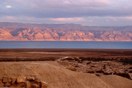
The Lower Jordan Valley adjoins the Jordan River between the southern tip of the Sea of Galilee and the northern tip of the Dead Sea. From sea to sea, the distance is only 65 miles. But because the Jordan River meanders, its waters actually cover 200 miles, dropping some 600 feet in elevation before emptying into the Dead Sea.
Joshua allotted the west side of the Lower Jordan Valley to the tribes of Issachar, Manasseh, Ephraim, and Benjamin. The tribe of Gad received most of the east side.
In biblical days, Succoth, a town east of the Jordan River, became the place where Jacob built himself a house (Gen. 33:17). Near there, in the Jordan plain, Solomon cast the copper for the Temple utensils (1 Ki. 7:46). Under Joshua, the waters of the Jordan River “stood still, and rose in a heap” some 20 miles away at the village of Adam to allow the children of Israel to cross (Josh. 3:16).
Israel had camped on the plains of Moab, opposite Jericho, at the widest spot (14 miles across) of the Jordan Valley (Num. 22:1). Jericho itself, located on the west side of the Jordan Valley, is well known for being conquered by Joshua and as the place where Jesus healed blind Bartimaeus (Josh. 6:2; Mk. 10:46). To get to Jericho, Jesus likely trod the well-beaten road that led down the eastern side of the Lower Jordan Valley. It was easier to travel this road than to traverse the Judean mountains. It is also likely Joseph and Mary took this same road on their way to Bethlehem when Mary was pregnant with Jesus. The Lower Jordan Valley was also where John the Baptist baptized hundreds, including Jesus Himself (Mt. 3:5–6, 13).
Israel drained Lake Semechonitus (also called Lake Hula) in the 1950s. Today the Hula Basin is one of the most fertile farmlands in all of Israel, producing cotton, fruit, and a variety of vegetables. Numerous fish hatcheries are there as well.
Much of the Lower Jordan Valley serves as Israel’s eastern border. The northern section of the Lower Jordan Valley abounds with fruit and vegetables.
Interestingly, the Jordan Valley lies on a major geological rift known as the Syrian-African fault. Earthquakes are common. An earthquake from this rift, measuring 5.0 on the Richter scale, struck Israel in February 2004. Israel’s Dr. Amos Salamon, research geologist at the Geological Survey of Israel, predicted at that time “with 90 percent confidence, that the next major quake will happen within 50 years.”1 In the future Tribulation, a great earthquake will kill 7,000 people in the city of Jerusalem (Rev. 11:13). It is possible that the shifting of the Jordan Rift will cause that earthquake as well.
ENDNOTE
- Jenny Hazan, “Our Quaking Capital,” February 19, 2004 <www.jpost.com/servlet/Satellite?pagename=JPost/JPArticle/ShowFull&cid=1077164215569>, accessed March 3, 2004.